About Cherrapunji

Country: India | State: Meghalaya

Ideal Trip Duration: 1-2 Days

Nearest City to Cherrapunji: Guwahati (146 Kms), Shillong (54 Kms)

Best Time to Visit Cherrapunji: September to May

Peak Season: March to April

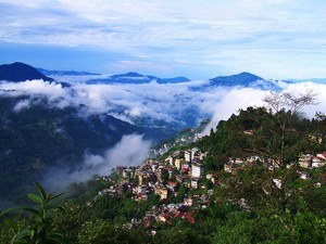
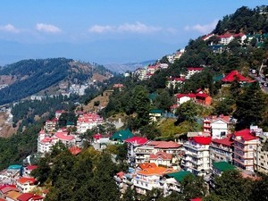
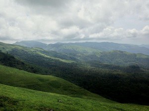
At a distance of 54 km from Shillong, 80 km from Mawsynram, 84 km from Dawki, 146 km from Guwahati, 292 km from Tezpur, Cherrapunji or Cherrapunjee is a small sub divisional town in the East Khasi Hills district of Meghalaya. It is one of the wettest places on the earth and among the must visit places in Meghalaya as part of honeymoon tour packages.

The original name for this town was Sohra, which was pronounced 'Churra' by the British. This name eventually evolved into the current name, Cherrapunji, which means the 'land of oranges'. According to the history, Cherrapunji is the traditional capital of a Nongkhlaw hima, an independent Khasi state. Between 16th and 18th centuries, the local residents were ruled by their tribal Syiems (chiefs) of Khyriem in the Khasi Hills. Tirot Sing was the last important Syiem of this area, who later admitted to the British in 1883 and ruled this place till independence.

Receiving an annual rainfall of about 11,777 mm, Cherrapunji happens to be the second wettest place on the planet after Mawsynram. The town receives both south-west and north-east monsoons. Despite receiving an abundant rainfall, Cherrapunji faces an acute water shortage and the inhabitants have to trek very long distances to obtain potable water. The excessive rain causes soil erosion which has deprived the land of Cherrapunji and the surrounding valleys.

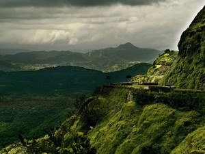
Located in Meghalaya, Cherrapunji is a paradise for monsoon lovers and nature enthusiasts as it is home to several gorgeous waterfalls, beautiful limestone caves, living root bridges and other stunning natural attractions. David Scott Trail, Maswmai Cave, Mawkdok Dympep Valley, Seven Sister Waterfalls, Nohkalikai falls, and Thangkharang Park are the top places to visit in Cherrapunjee. Cherrapunji is also an ideal place for trekking and soaking up the peace that nature offers. The most popular trekking route is the one that leads to the Double Decker Living Root Bridge in Nongriat village.

Nongkrem Dance and Shad-Suk Mynsiem are the two important festivals of Cherrapunji. Nongkrem Dance is an annual dance festival celebrated for five days every year in the month of October or November. The tribes in Cherrapunji perform the Nongkrem dance with pomp and gaiety. Shad-Suk Mynsiem is a dance festival, where the Khasi people thank the Almighty for the year that went by.

Guwahati Airport is the nearest major airport which is about 166 km from Cherrapunji and is well-connected by flights with cities like Kolkata, Mumbai, Delhi, Hyderabad, Bangalore, Chennai and Jaipur. About 146 km, Guwahati Railway Station is the nearest rail head to Sohra which is well connected by train with Kolkata, Delhi, Agartala, Mumbai, Bikaner, Dibrugarh, Tambaram, Bangalore, Silchar, Trivandrum, Hyderabad, Patna, Kanyakumari, Amritsar, Chandigarh, Chennai and Jammu Tawi. Shillong is the nearest bus station from where frequent state buses run between Shillong and other regions of Assam and Meghalaya to reach Cherrapunji. Frequent state buses, cabs or taxis are available from Shillong to reach Cherrapunji.


From guest houses to resorts and from cottages to homestays, Cherrapunji has several options for accommodation. Some of these hotels and resorts are boutique properties in remote scenic locations while some are larger and closer to town.

Cherrapunji is perhaps the only place in India, which has just one season that is monsoon. The rainfall varies from heavy to medium to light, but there is no month without rain. So, the best time to visit Cherrapunji is between the months of October and May, when the weather remains cool and pleasant. It's advisable to avoid a visit to Cherrapunji during the peak monsoon season.

...read more

Other Info
Internet Availability: Poor
STD Code: 03637
Languages Spoken: Khasi, Bengali, English & Hindi
Major Festivals: Nongkrem Dance & Shad-Suk Mynsiem
Notes/Tips:
None

How to Reach Cherrapunji

By Air

Nearest Airport: Guwahati - Lokpriya Gopinath Bordoloi International Airport (166 Kms)

By Train

Nearest Train Station: Guwahati Railway Station (146 Kms)

By Bus

Nearest Bus Station: Shillong (54 Kms)

Top 10 Places to Visit in Cherrapunji

#4 of 18 Places to Visit in Cherrapunji

At a distance of 4 km from Cherrapunjee Bus Stop, Nohsngithiang Falls is a picturesque waterfall located at Mawsmai village in East Khasi Hills district of Meghalaya. Also known as Seven Sister Falls and Mawsmai Falls, it is one of the tallest waterfalls in India and among the major places to visit in Cherrapunjee.

Located in the wettest place on Earth, Cherrapunjee, Nohsngithiang Falls is a seven segmented waterfall that cascades down from a height of 315 m (1,033 feet) and has an average width of 70 m (230 feet). The falls plunges over the top of limestone cliffs of the Khasi Hills only during the rainy season. The seven segments of the waterfalls symbolize the seven sister states in northeast namely Assam, Arunachal Pradesh, Manipur, Nagaland, Tripura, Mizoram and Meghalaya.

The best time to visit this place is during the monsoon, when the streams are flooded with water and flow down rapidly forming a perennial rainbow, which gives the spectacular views for the tourists. .....

...read more

#5 of 18 Places to Visit in Cherrapunji

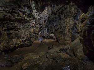
At a distance of 4 km from Cherrapunji Bus Stand, Mawsmai Cave is a beautiful limestone cave located at Cherrapunji in the North East Indian state of Meghalaya. It is one of the most popular historical Caves in Meghalaya and among the best places to experience Cherrapunji Tourism.

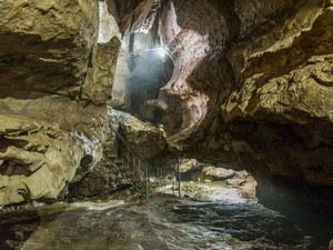
Revered as one of the most popular and notable landmarks in Cherrapunji, the striking natural cave is flocked by visitors in great numbers. Mawsmai Caves are formed out of limestone and enjoy the distinction of being the only caves in Meghalaya that are lit enough so that the tourists can enjoy its natural formations. Though the caves are quite long, only a distance of 150 meters is open for tourists while the remaining section is closed. This magnificent natural wonder is the handiwork of years of natural erosion and underground water.

The cave has a spacious opening but it soon squeezed into a narrow path. The interior is spacious as far as the cave goes, and some of the halls inside look like .....

...read more

#6 of 18 Places to Visit in Cherrapunji

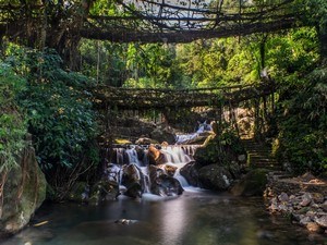
At a distance of 15 km from Cherrapunjee, the Double Decker Root Bridge is a living root bridge located at Nongriat village near Cherrapunji in Meghalaya. It is one of the prime tourist places in Meghalaya and among the most popular places to visit in Cherrapunji.

Crafted by the local Khasi tribes, the living root bridges of Nongriat village are one of the manmade wonders, dating back many centuries. This man made bridge is built by intertwining the aerial roots of Rubber Trees around a Betel Tree truck placed across a stream. The roots keep growing out and entwining the trunk and the bridge is elongated to the desired destination taking about 10-15 years to completion. The roots thicken over time and the bridge is further strengthened with stones, sticks, leaves, bamboos and other items serving the purpose for hundreds of years. This is the only means for the villagers to cross the streams to reach the other side.

There are two living root bridges in Nongriat, a single deck .....

...read more

#7 of 18 Places to Visit in Cherrapunji

At a distance of 11 km from Cherrapunji Bus Stand, Dainthlen Falls is a gorgeous waterfall located in Cherrapunji, Meghalaya. It is one of the popular waterfalls in Meghalaya and among the important places to visit in Cherrapunji.

Cascading down from a height of about 90 m, Dainthlen Falls is among the famous waterfalls in Cherrapunji which attracts large number of tourists every year. There is a small legend associated with the name of this fall. According to locals, there was a huge demon python by the name of Thlen who was drenched in greed and power. Some brave men caught the animal and destroyed its hood with a huge stone near this fall. Tourists visiting the waterfall can explore the natural rock carvings of the snake, which represent the symbol of evil, greed and corruption.

A few minutes of careful walk is required to reach the iron fence from where one will able to witness the gushing waterfall. There was no proper road to reach the viewpoint, it was bit tricky to .....

...read more

#8 of 18 Places to Visit in Cherrapunji

At a distance of 3.5 km from Cherrapunji Bus Stand, Arwah Cave is a huge cave located at Khliehshnong area of Cherrapunji in Meghalaya. Known for its limestone formations and the fossils, it is one of the popular caves in Meghalaya and among the spectacular tourist places in Cherrapunji.

Surrounded by the thick forest of Law Shynna in Meghalaya, Arwah Cave is an absolute treat for adventure and archaeology junkies. The cave itself is significantly larger than Mawsmai but only a small part of the cave has been opened for tourists. It is about 300 meters which takes 20 minutes to explore. Arwah Cave was discovered until recently and was least explored. It is very dark and creepy inside especially when crawling through the narrow tunnels. There are many chambers and narrow passages in the cave.

Arwah Caves are known for their limestone formations and the fossils which are believed to be millions of year old. The explorers and adventure lovers have spotted various fossils in the .....

...read more

#9 of 18 Places to Visit in Cherrapunji

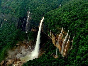
At a distance of 7.5 km from Cherrapunji Bus Stand, Nohkalikai is a scenic waterfalls located in Cherrapunji, Meghalaya. Tucked in between evergreen rainforests of Khasi Hill, it is one of the most popular waterfalls in Meghalaya and among the prime places to visit in Cherrapunji.

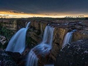
Nohkalikai is the tallest plunge waterfall in India and the 4th highest falls in the World. The water cascades down from a height of about 335 meters into a pool. Strangely, the pool is as blue as the sky in winter and green in summer. The fall is fed by the rainwater collected on the summit of a small plateau and decrease in power during the dry season. Surrounded by enchanting lush greenery, Nohkalikai is a paradise for nature lovers and photo fanatics.

Noh Ka Likai means 'the leap of Likai' in local Khasi language. The name of the falls is attached with a sad story of woman named Ka Likai who remarried a man, who believed that she loved her daughter more than him. So one day while Ka Likai was .....

...read more

#10 of 18 Places to Visit in Cherrapunji

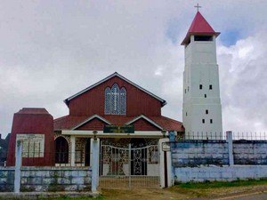
At a distance of 1 km from Cherrapunji Bus Stand, Nongsawlia Presbyterian Church is a catholic church in Cherrapunji, Meghalaya. Situated on Sohra - Shella Road, this is the oldest church in Meghalaya and one of the best places to visit in Cherrapunji.

Built in 1846 AD, it is the first Presbyterian Church in Meghalaya and also in North East India. The church was founded by Thomas Jones, the first missionary to the Khasi hills and the founder of the Khasi script. The church was destroyed in the great earthquake happened in 1897 and was rebuilt. Alongside stands the primary school established in 1843 by Thomas Jones.

The church looks grand due to its magnificent structure with a beautiful bell tower. The surroundings of this church and the church itself is absolutely breathtaking. There is a graveyard on top of a hill from which one can get magnificent views of the Nongsawlia area.

Timings: 8 AM - 4 PM

...read more

#1 of 18 Places to Visit in Cherrapunji

At a distance of 98 km from Guwahati, 377 km from Dhaka, 414 km from Kohima, 420 km from Cooch Behar, 572 km from Siliguri, 594 km from Darjeeling, 631 km from Gangtok and 1116 km from Kolkata, Shillong is a mesmerizing hill station in East Khasi Hills district of Meghalaya in India. Shillong is the capital city of Meghalaya as well as the headquarters of East Khasi Hills district. It is one of the most picturesque hill stations in India and among the must include places in your honeymoon tour packages.

Perched at an attitude of 1496 m, Shillong is situated on a plateau bounded by the Umiam gorge on the north, Diengiei Hills on the northwest, and the hills of the Assam valley on the northeast. Shillong Peak is the highest point in Shillong with an altitude of 6449 feet. The city gets its name from the deity Shyllong or Lei Shyllong, who is worshipped at the Shillong Peak. The British fondly called Shillong the 'Scotland of the .....

Distance (From Cherrapunji): 54 Kms
Trip Duration (From Cherrapunji - Including Travel): 1-2 Days
.....

...read more

#2 of 18 Places to Visit in Cherrapunji

At a distance of 60 km from Shillong, 63 km from Nongkrem, 81 km from Cherrapunjee, 104 km from Mawlynnong, 107 km from Dawki, and 152 km from Guwahati, Mawsynram is a scenic village located in East Khasi Hills district of Meghalaya. It is the wettest place on the earth and among the best places to visit in Meghalaya.

Situated at an altitude of 1400 m, Mawsynram is the rain lover's paradise as it receives the highest rainfalls in India. With 11,872 mm of rainfall received annually, Mawsynram beats Cherrapunji by a slender margin. Cherrapunji receives 11,777 mm of rainfall. The rains are so intense in Mawsynram that the villagers use thick grass to sound-proof their homes from the thunderous rain. The 'Maw' in Mawsynram is a Khasi word meaning 'stone'. It symbolizes the unique megaliths unearthed in the Khasi Hill area.

Apart from rains, Mawsynram is also known for lush green vegetation, floating clouds, roaring waterfalls and the colourful orchids. Mawjymbuin Cave, Mawlyngbna .....

Distance (From Cherrapunji): 81 Kms
Trip Duration (From Cherrapunji - Including Travel): Full Day
.....

...read more

#3 of 18 Places to Visit in Cherrapunji

At a distance of 30 km from Mawlynnong, 57 km from Jowai, 71 km from Nongkrem, 80 km from Shillong, 84 km from Cherrapunjee, 95 km from Mairang, 172 km from Guwahati, 205 km from Kamrup, 223 km from Morigaon, 265 km from Barpeta, Dawki or Dauki is a small town in West Jaintia Hills district of Meghalaya. Situated on the banks of Umngot River, it is one of the beautiful places to visit in Meghalaya.

Sandwiched between India and Bangladesh, Dawki is a border town in Jaintia Hills. It is also a major center of trade between India and Bangladesh. Dawki-Tamabil is one of the few road border crossings between India and Bangladesh which is mainly used for coal transportation to Bangladesh and also other places of India. The crystal clear Umngot River of Dawki is a major attraction that marks the natural separation between the Khasi and Jaintia Hills.

Besides being a trade hub, this small town is known for its immense natural beauty. Umngot River, Umngot Bridge, Jaflong Zero Point .....

Distance (From Cherrapunji): 84 Kms
Trip Duration (From Cherrapunji - Including Travel): Full Day
.....

...read more