1
DAY 1 : TRAVEL TO WAYANAD & SIGHTSEEING
DAY 1 : TRAVEL TO WAYANAD & SIGHTSEEING
 Sightseeing
Leisure / No Sightseeing
About Banasura Sagar Dam
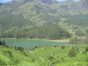
At a distance of 21 km from Mananthavady, 22 km from Kalpetta, and 46 km from Sulthan Bathery, Banasura Sagar Dam is an earthen dam situated in the Wayanad district of Kerala. The dam was built across the Karamanathodu River, a tributary of River Kabini, and is one of the most popular
Wayanad tourist places.
Ideally placed in the foothills of Banasura hills, it is the largest earthen dam in India and the second largest in Asia. The dam got its name from Banasura, the son of King Mahabali, the famous ruler of Kerala. It is said that Banasura undertook severe penance on the top of the hills. Banasura hill is the third-largest peak in the Western Ghats.
History of Banasura Sagar Dam
The dam was built in 1979 under the Indian Banasura Sagar Project which was started to support the Kakkayam Hydro Electric Power Project. This project also aimed at contributing to the drinking .....
 Duration of visit: 2 Hours
 Timings: 9 AM to 5 PM, Boating Time: 9 AM to 4 PM
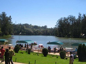
At a distance of 3 km from Vythiri, and 13 km from Kalpetta, Pookote Lake, also known as Pookode Lake is a natural freshwater lake situated close to the Kalpetta - Kozhikode main road in the Wayanad district of Kerala. It is one of the must-visit Wayanad sightseeing places.
At an altitude of about 2500 feet, this fascinating natural freshwater lake is surrounded by evergreen forests and rolling hills. The lake has the shape of India's map. The lake is spread across an area of 13 acres with a maximum depth of 6.5 m. The Panamaram stream, one of the main tributaries of the Kabani River, originates from Pookote Lake.
The lake has an abundance of blue lotus and freshwater fishes. Pethia pookodensis is a species of cyprinid fish known to occur only in Pookode Lake. The forests surrounding the lake hold many wild animals, birds, and flies. The view of this vast expanse of water in the picturesque backdrop .....
 Duration of visit: 1 Hour
 Timings: 9 AM to 5 PM
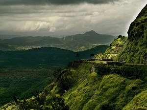
At a distance of 16 km from Kalpetta & 4 km from Pookote Lake, Lakkidi is small hill station situated at the highest point in the Wayanad district. Located at an altitude of about 700 m, Lakkidi gets about 600 cm rainfall annually, making it one of the highest rainfall regions in Kerala and also one of the prime Wayanad tourist places to visit.
Often referred as 'the gateway of Wayanad', Lakkidi is located at the crest of the serpentine Thamarassery ghat pass, which features over 9 hairpin curves that start at Adivaram (downhill). The 12 km long ghat road from Adivaram to Lakkidi passing through thick forest leaves a wonderful experience. The lush green hills, gorges and streams on both sides of the passage up the hill are breathtaking sights to the visitors.
This beautiful hill town has a number of scenic locations and enchanting viewpoints. Lakkidi Viewpoint .....
 Duration of visit: 15 Mins
 Timings: 6 AM to 6 PM
2
DAY 2 : WAYANAD SIGHTSEEING
%%Itinerary_Title_Day2%%
About Edakkal Caves
At a distance of 6 km from Ambalavalayal, 14 km from Sulthan Bathery, and 28 km from Kalpetta, Edakkal Caves are two natural caves located on top of Ambukutty Mala near Ambalavalayal in Wayanad. It is one of the popular places of
heritage in Kerala, and among the must-include places in the
Wayanad tour.
The Edakkal caves are of historical and archaeological significance as it has carvings that date back to the Neolithic era, the late Stone Age. The caves have two levels accessible through narrow iron steps. The lower chamber is around 18 feet long and 10 feet high. A small path from here leads to the upper chamber which is around 95 feet long and 18 feet high. These caves are natural rock formations that were formed by a large split in a huge rock. The stone walls in the upper chamber have several line drawings belonging to the Neolithic Age dating back to 6000 BC, the earliest drawings .....
 Duration of visit: 2 Hours
 Timings: 9 AM to 4 PM (Closed on Mondays)
At a distance of 11 km from Sulthan Bathery & 5 km from Edakkal Caves, 22 km from Kalpetta, Wayanad Heritage Museum is located in Ambalavayal village.
This is one of the best heritage museums in Kerala. The museum houses fascinating items from tribal communities dating back to the second century AD. It has a rare collection of several ancient instruments & tribal artifacts like jewellery, hunting and fishing weapons, farming instruments, a fine collection of 14th - 16th century sculptures, etc. Ancient terra cottas, stone weapons and local art are also on display at the museum.
A series of pictorial rock edicts referred to as Hero Stones, memorialize a bygone age of warriors. There is a fine figure of the Goddess of fertility, Urvara, also displayed here. Most of the artifacts are collected from the Wayanad and surrounding regions.
The museum is spread in two levels with statues occupying lower level while the tribal artifacts are displayed in first level. The museum .....
 Duration of visit: 30 Mins
 Timings: 10 AM to 5 PM
BREAK FOR MEALS / HOTEL CHECK-IN | CHECK-OUT / SHOPPING / LEISURE
At a distance of 8 km from Meppadi and 19 km from Kalpetta, Kanthanpara is a quaint little waterfall situated near Meppadi in the Wayanad district of Kerala. Located on Vaduvanchal road, it is one of the popular waterfalls in Kerala and among the must-include places in Wayanad sightseeing packages.
Kanthanpara waterfall drops down from a height of about 100 feet and is widely acknowledged for its secluded and serene vibe. The waterfall is located at two levels amid lush green bamboo gardens and natural forests. The breathtaking attraction of the path leading to Kanthanpara waterfall seems to more beautiful than the fall itself. This scenic and quaint waterfall is a must-visit place for every tourist on a trip to Wayanad.
The tea gardens on both sides elevate its beauty and provide an excellent spot for soft trekking too. This place is a perfect blend of adventure and tourism as the forest department providing bird-watching .....
 Duration of visit: 2 Hours
 Timings: 9 AM - 4.30 PM, Bird Watching: 6 AM - 9 AM, Trekking: 8 AM - 3 PM
3
DAY 3 : VISIT IRUPPU FALLS - NAGARHOLE & TRAVEL TO MYSORE
%%Itinerary_Title_Day2%%
 Sightseeing
At a distance of 248 km from Bangalore, 110 km from Mysore, 75 km from Madikeri, 48 km from Virajpet, 32 km from Gonikoppal, 20 km from Nagarhole National Park, 10 km from Kutta & 10 km from Srimangala, Iruppu Falls is a magnificent waterfalls situated in Brahmagiri Hills between Srimangala & Kutta in Coorg district of Karnataka State, bordering the Wayanad district of Kerala. It is one of the best waterfalls in Karnataka and also one of the well-known Coorg tourist places. It can be visited as part of 2 day trip from Bangalore.
Also known as Lakshmana Tirtha Falls locally, Irupu Falls or Iruppu Falls is another popular attraction not to .....
 Duration of visit: 1-2 Hours
 Timings: 8 AM – 6 PM
BREAK FOR MEALS / HOTEL CHECK-IN | CHECK-OUT / SHOPPING / LEISURE
At a distance of 10 km from Kutta, 20 km from Iruppu Falls, 62 km from Kalpetta, 88 km from Mysore, 88 km from Madikeri, and 218 km from Bangalore, Nagarhole National Park is one of the best wildlife sanctuaries in India and among the must include places in Karnataka Tour Packages. Also known as Rajiv Gandhi National Park, it is spread across Mysore and Kodagu districts in Karnataka.
Nagarhole National Park is one of the top attractions you must include in Coorg tour packages. Originally the forest area was the private hunting ground for the Maharajas of Mysore. It was converted into a sanctuary in the year 1955 covering an area of 258 sq. km and subsequently enlarged to include the adjoining areas of Mysore district and now extends over an area of 643 sq. km. Nagarhole got National Park status in 1988 and declared as 37th Project .....
 Duration of visit: 2-3 Hours
 Timings: Safari Timings: 6 AM - 9 AM and 2.30 PM - 5.30 PM

